

Carrie-Ann Houdeshell is a Grazing Land Co-Lead for the Conservation Effects Assessment Project (CEAP), an effort led by USDA’s Natural Resources Conservation Service (NRCS) to evaluate and inform voluntary conservation across the nation’s working lands. In this Ask the Expert, Carrie-Ann answers questions about recent findings on three key grazing land conservation practices, new resources to assist data-driven conservation decision making across the nation’s non-federal grazing land and federal rangeland, and NRCS programs and services to support ranchers and other land managers in pursuing voluntary conservation.
Let’s start with the basics: When we talk about “grazing land,” what is included?
Grazing land is a collective term that includes rangeland, pastureland, grazed forests, native and naturalized pasture, hayland, and grazed cropland. All 50 states have grazing land, and the national grazing land footprint is incredible – approximately 40 percent of all land across the United States. That includes more than 580 million acres of private land and more than 390 million acres of land managed by federal agencies.
Ranchers and other land managers use grazing land to feed and raise livestock, providing food and fiber for the United States and beyond. Through their stewardship, grazing land also delivers a suite of ecosystem services – like water conservation, wildlife habitat, and carbon sequestration – that benefit us all.
How does CEAP support ranchers and other land managers in grazing land conservation?
CEAP provides technical resources to support strategic, data-driven conservation efforts across the nation’s working lands. Specifically, CEAP Grazing Land Assessments evaluate the effects of conservation practices, and areas where enhanced conservation can address natural resource concerns.
We also provide web-based tools that enable ranchers, other land managers, and conservationists to assess past or current land conditions and plan strategic conservation goals for the future.
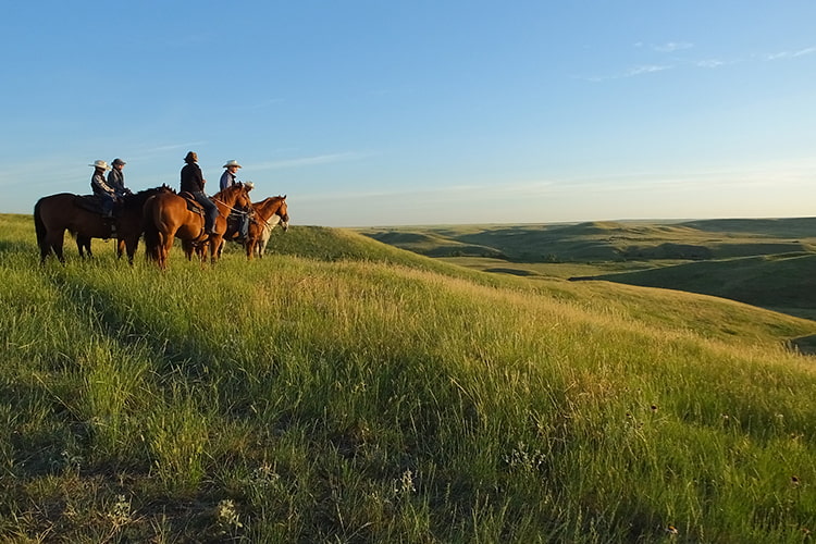
CEAP provides technical resources to support ranchers, other land managers, and conservationists in managing for healthy, productive grazing land. Photo Credit: Colette Kessler, NRCS South Dakota
You are an author on a new CEAP-supported report that evaluates the ecosystem service benefits provided by rangeland. What did you find?
This project was a collaboration between Earth Economics, the University of Arizona, and CEAP. As noted in the report, we can think of ecosystem services as “nature’s contributions to people.” This was an effort to quantify – in dollars and cents – the effects of three conservation practices on 13 ecosystem services provided by rangeland spanning more than 351 million acres across 11 western states.
The conservation practices of focus were brush management, herbaceous weed treatment, and prescribed grazing. Each activity may provide ecosystem services including carbon sequestration, wildlife habitat, soil fertility and retention, water supply, and more. We found these three conservation practices result in an average increase in ecosystem services of $45.70 per acre annually on non-federal rangeland compared to a baseline without practices applied. Bottom line, the effects of voluntary conservation on sustainably managed rangeland are quantifiable, and they benefit everyone.
We have a free, one-hour webinar scheduled for 3 p.m. eastern on February 21 where we’ll share additional findings. Details, including access instructions, are available on our Conservation Outcomes Webinar Series webpage. I encourage you to attend!
Are there CEAP-supported tools or other resources you’d recommend that assist with conservation decision making?
Yes! Our CEAP Grazing Land Assessments webpage has a suite of articles and reports, fact sheets, webinar recordings, and tools to support voluntary conservation. Two tools we’ve recently released that I recommend as particularly useful for ranchers and other land managers are:
- The Rangeland Soil Vulnerability Index for Water Erosion Web Tool, which identifies rangeland areas that are susceptible to water erosion when dry and unvegetated. Users may leverage this to identify the need for proactive conservation measures before potential issues – such as rangeland health, soil stability, water infiltration, plant productivity, and invasive species – become problematic.
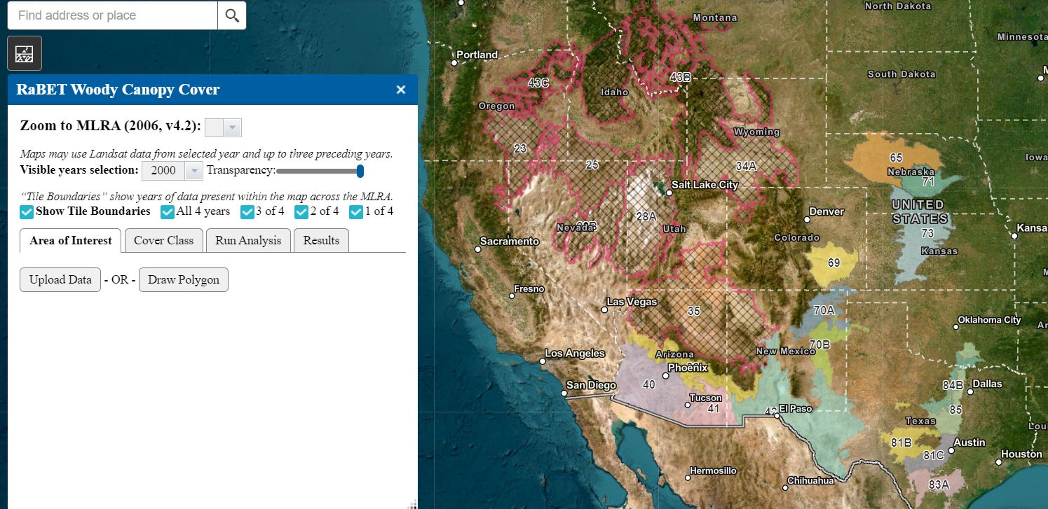
- The Rangeland Brush Estimation Tool, which estimates woody plant canopy cover over time. Users may leverage this to assess woody encroachment for an area that extends from Arizona to Texas and north into Colorado and Nebraska.
We may update the geographic range of these tools in the future.
Where can ranchers and other land managers learn more about USDA resources to support grazing land conservation?
Through NRCS, USDA offers financial assistance and one-on-one technical support to strengthen voluntary conservation efforts across private and Tribal lands nationwide. I encourage anyone interested in exploring opportunities for their unique management goals to contact the NRCS office at their local USDA Service Center.
Additionally, the Conservation at Work Video Series offers short videos on more than 70 NRCS conservation practices. You may filter by conservation type to consider options for your working land.
Carrie-Ann Houdeshell is a CEAP Grazing Land Co-Lead for the NRCS Resource Inventory and Assessment Division. She may be reached at Carrie-Ann.Houdeshell@usda.gov.
 Loans and Grants
 Disaster Planning and Assistance
 Conservation
 Ag Business
 Farm Life